


SW Maps - GIS & Data Collector
Descriere SW Maps - GIS & Data Collector
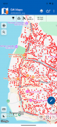
SW Maps este o aplicație gratuită GIS și de cartografiere mobilă pentru colectarea, prezentarea și partajarea informațiilor geografice.
Indiferent dacă efectuați un sondaj GNSS la scară completă cu instrumente de înaltă precizie, dacă aveți nevoie să colectați o cantitate mare de date bazate pe locație folosind nimic altceva decât telefonul dvs. sau trebuie doar să vizualizați câteva shapefile cu etichete pe o hartă de fundal din mers, SW Maps are totul acoperit.
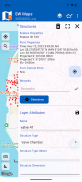
Înregistrați puncte, linii, poligoane și chiar fotografii și afișați-le pe harta de fundal aleasă de dvs. și atașați date despre atribute personalizate oricărei caracteristici. Tipurile de atribute includ text, numere, o opțiune dintr-un set predefinit de opțiuni, fotografii, clipuri audio și videoclipuri.
Efectuați sondaje GPS de înaltă precizie folosind receptoare externe capabile RTK prin Bluetooth sau USB Serial.
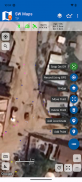
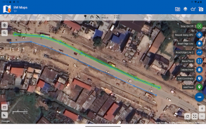
Desenați caracteristici pe hartă adăugând marcatori și măsurați distanța și zona.
Reutilizați straturile și atributele unui proiect anterior pentru un alt sondaj sau creați șabloane și partajați-le cu alți utilizatori.
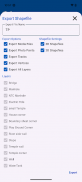
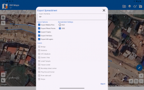
Partajați datele colectate cu alți utilizatori ca Geopachete, KMZ sau shapefile sau exportați-le în stocarea dispozitivului dvs. De asemenea, partajați și exportați datele înregistrate ca foi de calcul (XLS/ODS) sau fișiere CSV.
Caracteristici
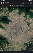
-Hărți de bază online: Google Maps sau Open Street Map
- Suport pentru mai multe mbtile și suprapuneri KML
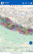
-Straturi Shapefile, cu un stil de atribut categorizat. Vizualizați fișierele shape în orice sistem de coordonate acceptat de biblioteca PROJ.4.
-Adăugați mai multe straturi online WMTS, TMS, XYZ sau WMS și plăci cache pentru utilizare offline.
-Conectați-vă la receptoare externe RTK GPS prin Bluetooth sau USB Serial pentru topografie de înaltă precizie folosind RTK. Înregistrați, de asemenea, date de la receptorul extern pentru postprocesare.
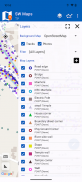
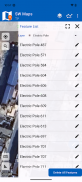
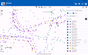
-Definiți un număr mai mare de straturi de caracteristici, fiecare cu un set de atribute personalizate
Tipuri de caracteristici: punct, linie, poligon
Tipuri de atribute:Text, Numeric, Opțiuni drop-down, Lista de verificare, Fotografii, Audio, Video
Salvați ca șablon pentru reutilizare sau partajare
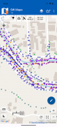
-Înregistrați traseele GPS, cu măsurarea distanței
-Desenați caracteristici pe hartă și exportați ca KMZ, Shapefiles, GeoJSON sau GeoPackages.
-Etichetați caracteristicile pe baza valorilor atributelor.
-Importați straturi de caracteristici din șabloane sau proiecte existente.
-Partajați sau exportați datele colectate ca KMZ (cu fotografii încorporate), shapefiles, GeoJSON, Geopackage (GPKG), foi de calcul XLS/ODS sau fișiere csv.
-Partajați șabloane sau proiecte cu alți utilizatori
-Tratați puncte și linii pe sol folosind receptoare GNSS de mare precizie.
Acest produs este fabricat în Nepal și este GRATUIT (fără reclame). Dacă găsești acest lucru util, anunță-le prietenilor tăi că ai folosit un produs din Nepal. Rezervați-vă cândva pentru a vizita această țară minunată și a cunoaște poporul nepalez.
SW Maps - GIS & Data Collector - Versiune 3.0.12.0
(23-04-2025)SW Maps - GIS & Data Collector - Informații APK
Versiune APK: 3.0.12.0Pachet: np.com.softwel.swmapsCea mai recentă versiune a SW Maps - GIS & Data Collector
Alte versiuni


Aplicații din aceeași categorie

S-ar putea să îți placă și...


